Coastal Marine
Litter Observatory
AI-powered marine litter detection and mapping using any drone — enabling real-time monitoring, analysis, and reporting at scale.
From drone imagery to compliance-ready insights in minutes.


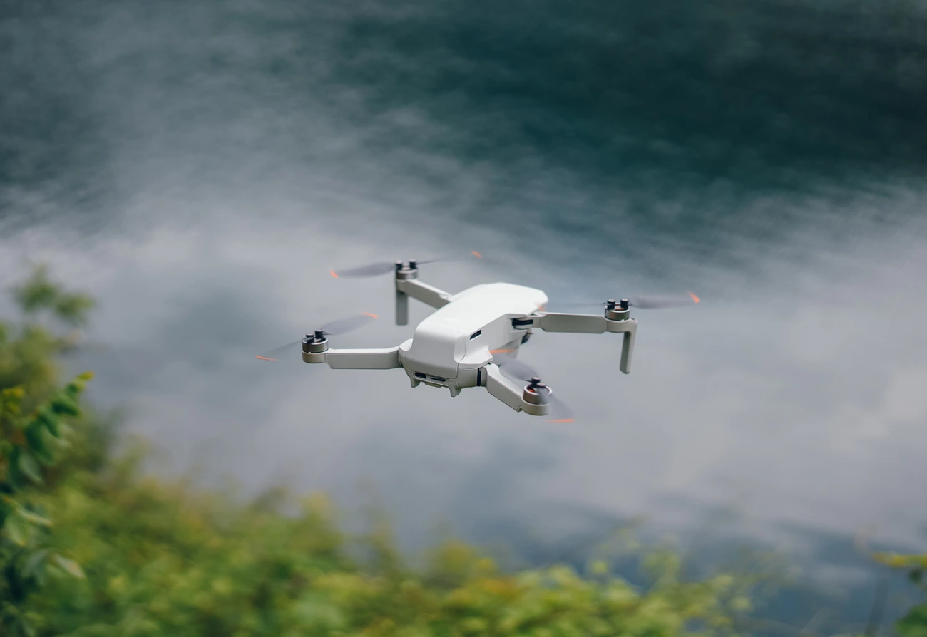
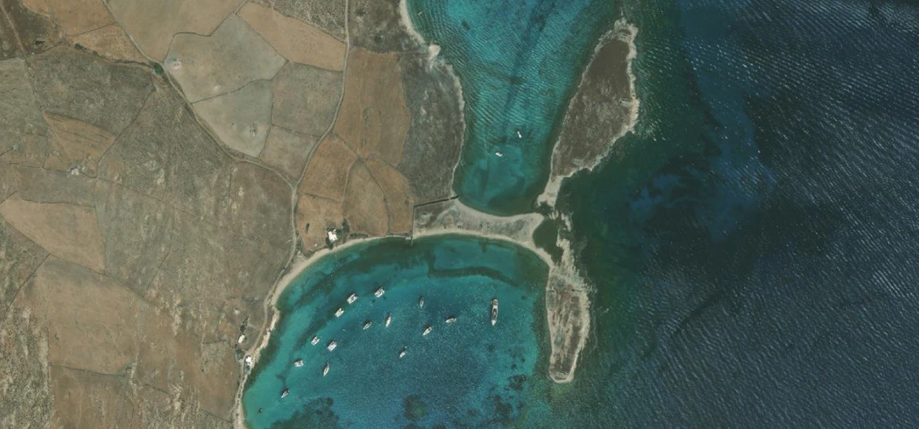
Capture coastal
CMLO enables fast and flexible data acquisition across coastlines of any type. Whether monitoring urban beaches, remote islands, or protected zones, drone missions can be deployed easily and repeatedly. Each image is enriched with precise geolocation data, ensuring accurate mapping and analysis.
Built for real
coastal monitoring
Whether your goal is environmental protection, regulatory compliance, or operational efficiency, CMLO provides the tools to transform raw data into actionable intelligence. It bridges the gap between observation and decision-making.

01. Environmental Monitoring
Track pollution levels across coastlines with consistent, repeatable data.
Understand what's happening on your shores

From invisible pollution to measurable data
Manual monitoring is slow, inconsistent, and difficult to scale.

Detects Litter
Automatically identifies marine debris from drone images.
No manual counting required
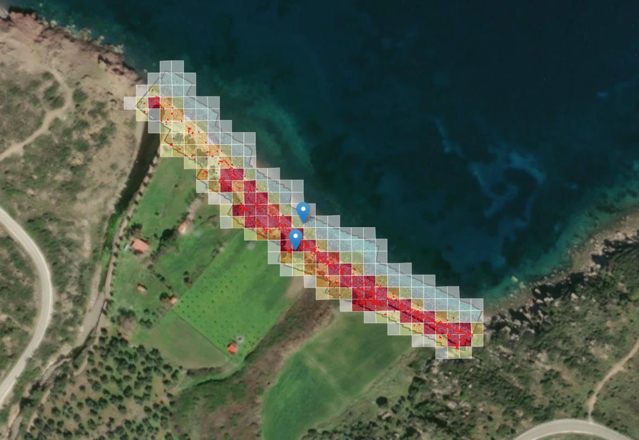
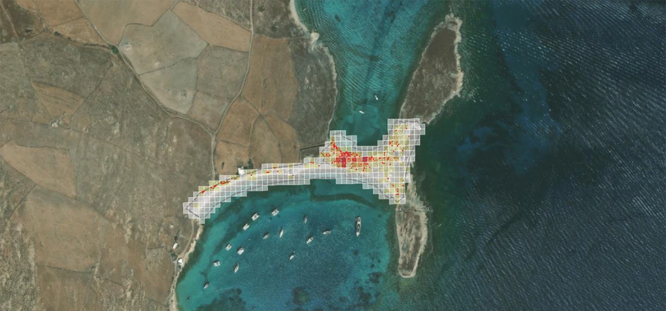
Maps Litter
Transforms detections into geospatial density maps.
See exactly where pollution accumulates
Analyzes Trends
Tracks changes over time across locations.
Understand patterns and evolution
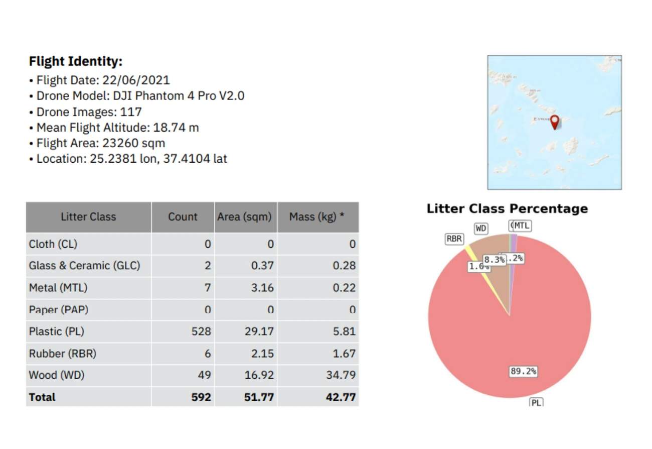
Generates Reports
Exports structured, ready-to-use outputs.
Support decisions and compliance instantly
Designed for multiple Stakeholders
CMLO supports organizations working to monitor and reduce marine pollution.


Proven across the world
CMLO has been deployed across diverse coastal regions worldwide.
From Raw Images to
clear
Without CMLO, monitoring is manual, inconsistent, and difficult to scale. With CMLO, every dataset becomes actionable — turning images into insights, and insights into decisions.
Before CMLO
- Scattered data
- Manual analysis
- Limited coverage
- No standardization
With CMLO
- Structured datasets
- Automated AI detection
- Scalable monitoring
- Ready-to-use insights

Start Monitoring Smarter
Turn your coastline data into actionable intelligence today.
- No setup required
- Works with your existing drone