Our Product
Detect, map, and analyze coastal marine litter using drone data — faster, more accurately, and at scale.
About
CMLO
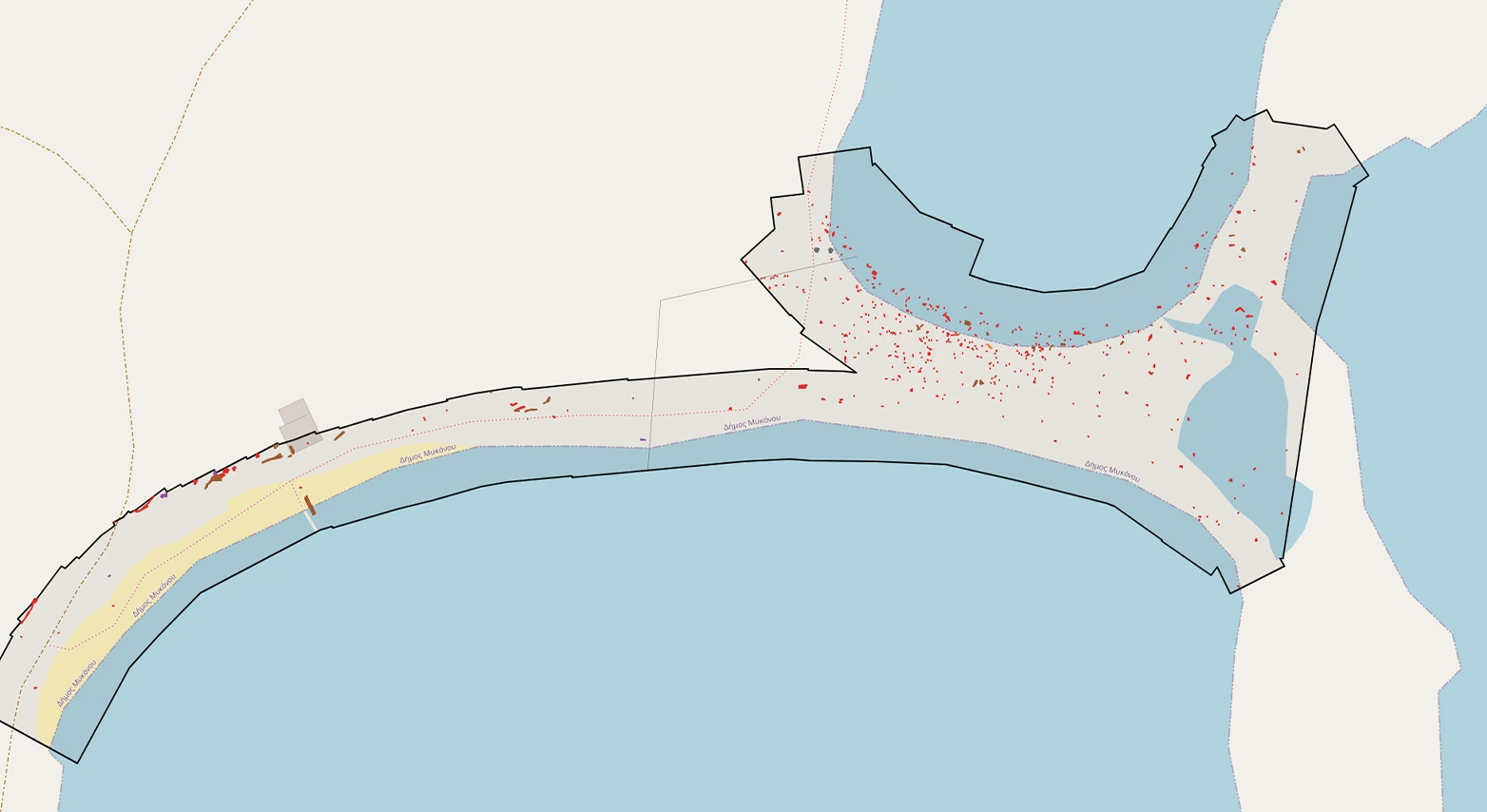
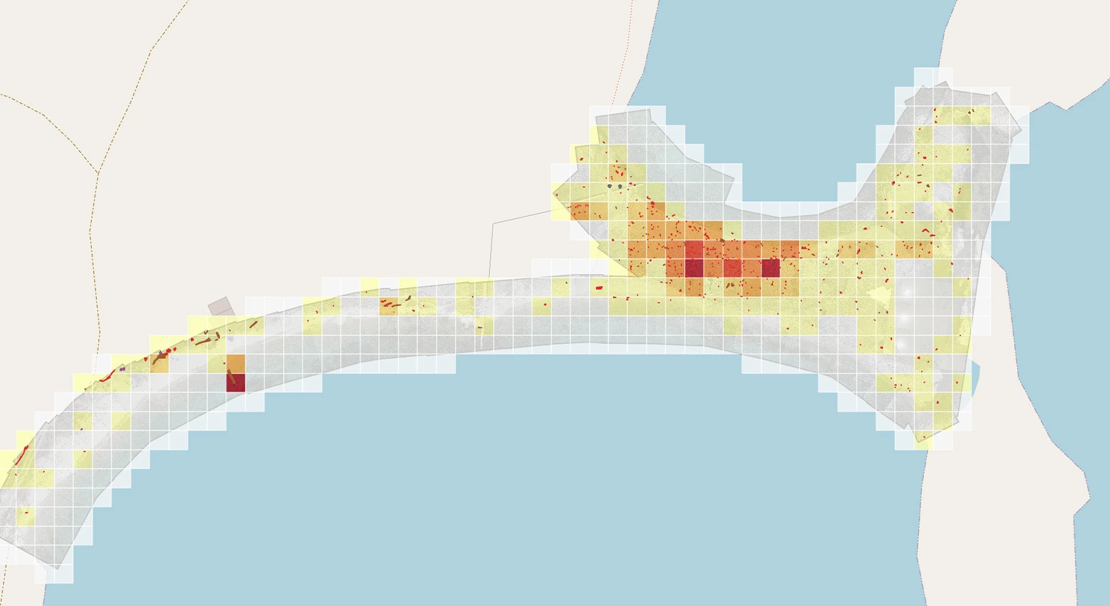
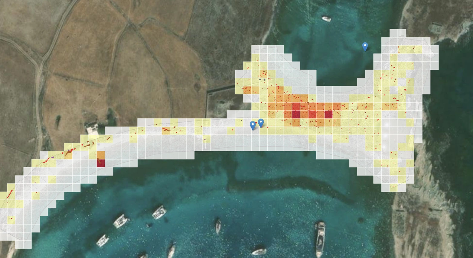
CMLO is an AI-powered coastal monitoring platform that automatically detects, classifies, and maps marine litter using aerial imagery from any commercial drone. Through the CMLO SDI portal, users can explore and compare results for each monitored beach, turning litter detection data into actionable insights for scientists, policymakers, municipalities, and coastal managers, while supporting evidence-based decisions, pollution hotspot identification, clean-up prioritisation, and long-term coastal protection actions.
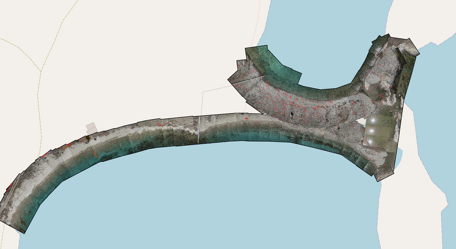
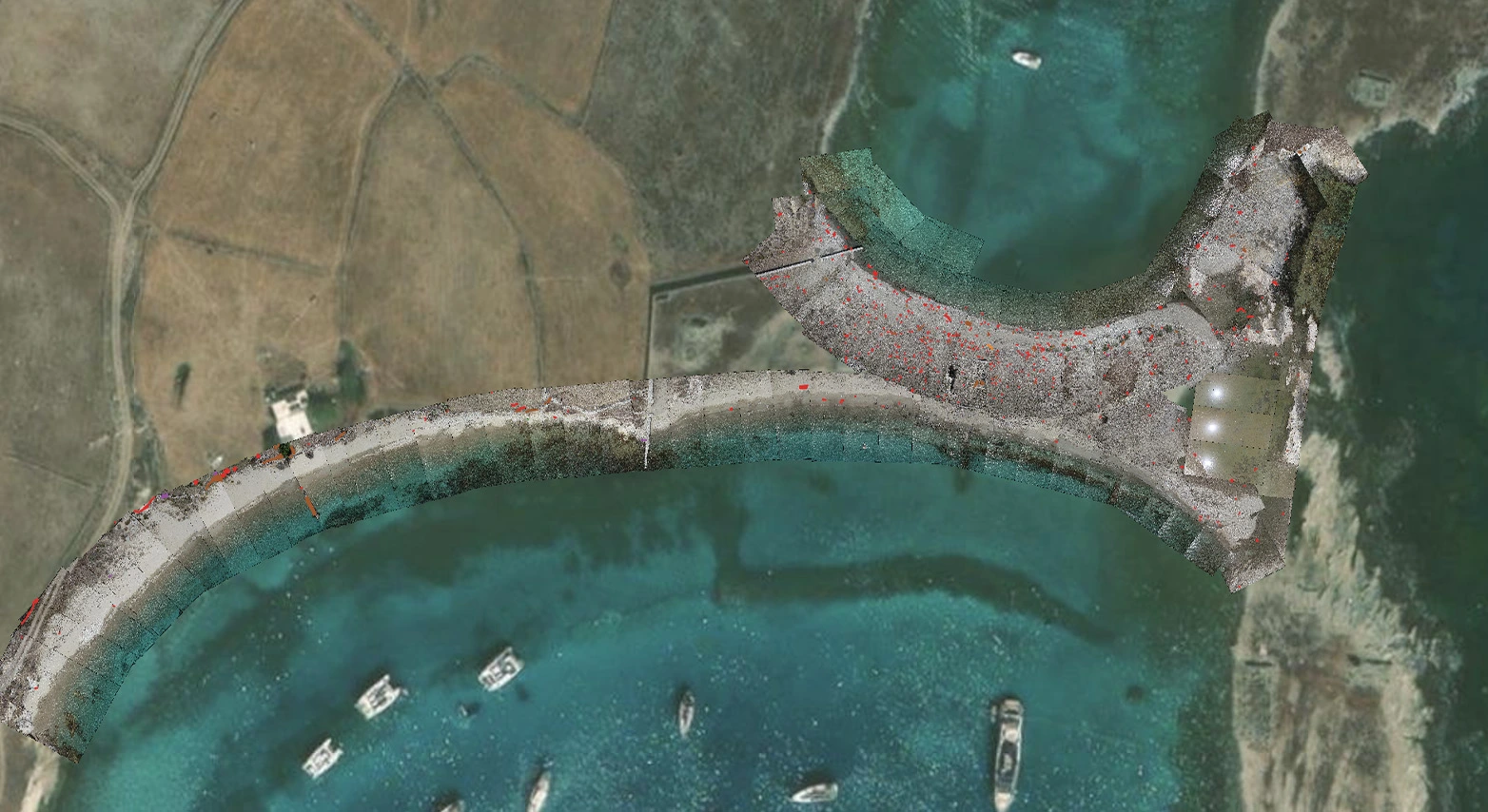
AS CAPTURED: RINEIA, GREECE (37.41145° N, 25.23466° E)

CMLO features
What you can do with CMLO.
Proven performance
Standardized and automated workflows ensure results that are scalable, comparable, and ready for confident decision-making.
90%
cheaper
Reduced costs by minimizing manual surveys and fieldwork

20x
faster
Rapid processing from data collection to insights
>85%
accuracy
Consistent and reliable detection powered by AI
90%
cheaper
Reduced costs by minimizing manual surveys and fieldwork
20x
faster
Rapid processing from data collection to insights
>85%
accuracy
Consistent and reliable detection powered by AI
Litter

Types of marine litter detected

Start Monitoring Smarter
Turn your coastline data into actionable intelligence today.
- No setup required
- Works with your existing drone